Digital Trails
Hiking in New Zealand in comfort.
Monday, August 28, 2006
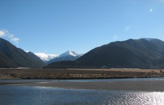
Upper reaches of the Waimakariri
Upper reaches of the Waimakariri
Originally uploaded by
mchnz
.
At this point the river is braided with wide shingle beds, snow capped hills rise around it (
maps.google.com
).
img_6497-1024x768-usm2
No comments:
Post a Comment
Newer Post
Older Post
Home
Subscribe to:
Post Comments (Atom)
No comments:
Post a Comment