The sunlight shone into the middle of this valley - if viewed large, you can see that the sunlight catches some power poles on the valley floor.
Monday, September 25, 2006

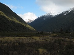
Climbing toward Otira
As we climbed toward the Otira side of Arthurs pass a little more sunlight started to be evident. It seemed likely that the other side of the alps would have clear skies.
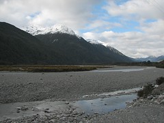
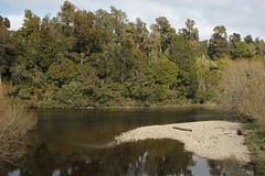
Shingle banks
I'm a bit lost as to the exact location of the images in this area - neither google maps or yahoo maps has sufficient resolution in this area.
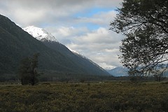
Climbing toward Otira 1
Light was a bit scarce at this point - I could have really benefited from a image sensor that copes better with poor light.
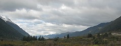
West Coast vista
This would have been a great place to take a panorama, but the train wasn't going to stand still - a wide crop is the best I could do.
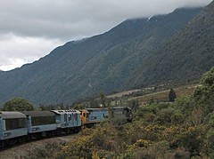
The TranzAlpine
There were quite a few oportunities to catch the train turning a corner - but I lucked out on getting a nice clear shot. I had to post process this image a fair bit - it was underexposed and noisy.
Sunday, September 24, 2006
West Coast in a moody light.
The cloud was still shrouding the West Coast for the return leg of the journey.
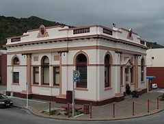
Bank of New Zealand Building
Former Bank of New Zealand building in Greymouth. We spent most of the short stopover in Greymouth geting a nice bite to eat at the The Smelting House Cafe on MacKay St.
The bank is located here (the railway station is at the east edge of the google map view).
The bank is located here (the railway station is at the east edge of the google map view).
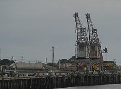
The Port of Greymouth
These two aged Greymouth cranes are the most prominent feature of the waterfront - they can be clearly seen here on google maps. I never got close to them - google maps shows coal piled up behind them (the West Coast produces large amounts of coal).
This image was taken from the river bank near the old BNZ building in the next image.
This image was taken from the river bank near the old BNZ building in the next image.
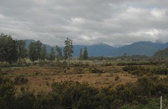
West Coast Forest
The train travelled parallel to a river somewhere between Moana and Greymouth. The opposite bank was well forested but rather hard to photograph because trees and scrub on the near side kept blocking the view.
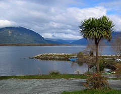
Lake Brunner / Lake Moana
View from the station at Lake Brunner (Lake Moana). Located here on google earth. Native "Cabbage" Tree in foreground.
My partner took this with a Canon A-80
My partner took this with a Canon A-80
Wednesday, September 06, 2006
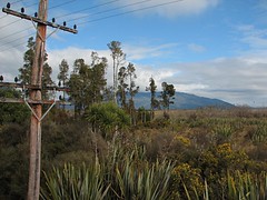
Rugged West Coast Scrub
Here we have a typical sampling of West Coast scrub land. Flax in the foreground. The flax-like bush standing up is the native "Cabbage Tree" (Ti Kouki). And of course, the yellow flowered shrubs are yet more introduced gorse.
As I described in my previous post, by looking at landmarks and buildings in surrounding images,I'd say this image was taken near the middle of this google maps view somewhere between Te Kinga and Ruru, just before Moana Station (the track runs along side Lake Brunner Road).
Gorse was introducted to New Zealand by European settlers. In New Zealand, gorse has no natural pests or diseases. Once the native bush and forests were burnt and cleared, gorse spread EVERYWHERE. We've personally spent many weekends with gloves, loppers, pruning saws, and Roundup (Glyphosate) keeping it under control (we are talking dump truck sized quantities from a domestic section - it really does get around). If kept under control, gorse is OK protection for regenerating native bush - so it's not all bad.
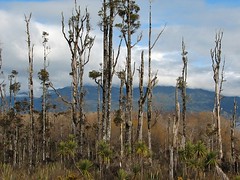
Tall and Scrappy
Stands of tall weathered trees are quite common. I guess it's the wild West Coast weather. The yellow flowers in the foreground are the flowers of the prickly gorse shrub. In front of the gorse we have native flax.
By looking at landmarks and buildings in surrounding images,I'd say this image was taken near the middle of this google maps view somewhere between Te Kinga and Ruru, just before Moana Station (the track runs along side Lake Brunner Road).
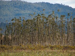
By looking at landmarks and buildings in surrounding images,I'd say this image was taken near the middle of this google maps view somewhere between Te Kinga and Ruru, just before Moana Station (the track runs along side Lake Brunner Road).
Tuesday, September 05, 2006
Te Kinga
This is most likely the Cashmere Bay Road bridge at Te Kinga (google earth hires) encountered just prior to Lake Moana (AKA Lake Brunner).
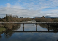
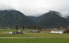
Farm near the Lake Brunner Road
By matching the hills in the background and the time the image was taken I suspect this image was taken near here on the google map view.
After exiting the Otira tunnel we were now on the rugged West Coast side of the Southern Alps. The transition to the West Coast was marked by the transition from clear to overcast skies. The weather for the trip was fine on both sides of the Alps. This is often not case because the Alps tend to bottle up bad weather on one side or the other. Our trip was booked a few days ahead after consulting the NZ Met Service's forcast for the week ahead.
This image was taken almost an hour after the previous one - I'm missing images for quite a chunk of the area from Otira to Lake Brunner. When covering the return journey, I'll post images of the area I missed on this outward leg.
I'm now using the new Flickr yahoo maps features, but the yahoo satellite images aren't as detailed as googles (just click on any image and when at yahoo click on the map links listed under each image).
Subscribe to:
Posts (Atom)