By matching the hills in the background and the time the image was taken I suspect this image was taken near here on the google map view.
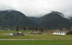
After exiting the Otira tunnel we were now on the rugged West Coast side of the Southern Alps. The transition to the West Coast was marked by the transition from clear to overcast skies. The weather for the trip was fine on both sides of the Alps. This is often not case because the Alps tend to bottle up bad weather on one side or the other. Our trip was booked a few days ahead after consulting the NZ Met Service's forcast for the week ahead.
This image was taken almost an hour after the previous one - I'm missing images for quite a chunk of the area from Otira to Lake Brunner. When covering the return journey, I'll post images of the area I missed on this outward leg.
I'm now using the new Flickr yahoo maps features, but the yahoo satellite images aren't as detailed as googles (just click on any image and when at yahoo click on the map links listed under each image).
No comments:
Post a Comment