Digital Trails

Hiking in New Zealand in comfort.

Saturday, October 14, 2006
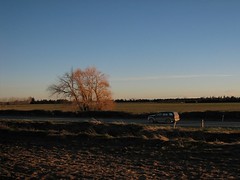
Final leg


Final leg
Originally uploaded by mchnz.
Tracking highway 73. Really zipping along at this point.
Posted by Digital Trails at 10:30 pm
Email ThisBlogThis!Share to XShare to FacebookShare to Pinterest

No comments:

Post a Comment

Newer Post Older Post Home
Subscribe to: Post Comments (Atom)

Search This Blog

About Me

digitaltrails
View my complete profile

Links

  • New Zealand Topo Maps
  • NZ Forecasts
  • NZ Mountain/Parks Forecast

Blog Archive

  • ►  2007 (34)
    • ►  May (1)
    • ►  April (31)
    • ►  March (2)
  • ▼  2006 (45)
    • ►  November (1)
    • ▼  October (14)
      • There and back again in one day.
      • Final leg
      • Sheep
      • Revisiting the Canterbury Plains
      • Viaduct (Broken River area?)
      • Evening sun on tussock
      • Bridge on Riversdale Road?
      • Distant clouds
      • Blue Waters
      • Highway 73
      • Bridge
      • Layer Cake
      • Leaving Arthurs Pass
      • GAS MASK AND MONITOR MUST BE CARRIED
    • ►  September (16)
    • ►  August (14)
Travel theme. Powered by Blogger.